FANCY A HIKE ON MARS?
5 SENSATIONAL LOCATIONS TO HIKE IN TENERIFE
The canary islands are one of Europe's top hiking locations, particularly in the winter. This island captivates at every turn, from sweeping volcanic scenery reminiscent of mars to rolling emerald mountains that stretch into the sea.
The Anaga mountains, Teide national park, and the Teno mountains are home to some of Tenerife's most beautiful hiking paths. We recommend staying on the island for at least one week to experience each of these places.
ROQUES DE GARCÍA
TEIDE NATIONAL PARK
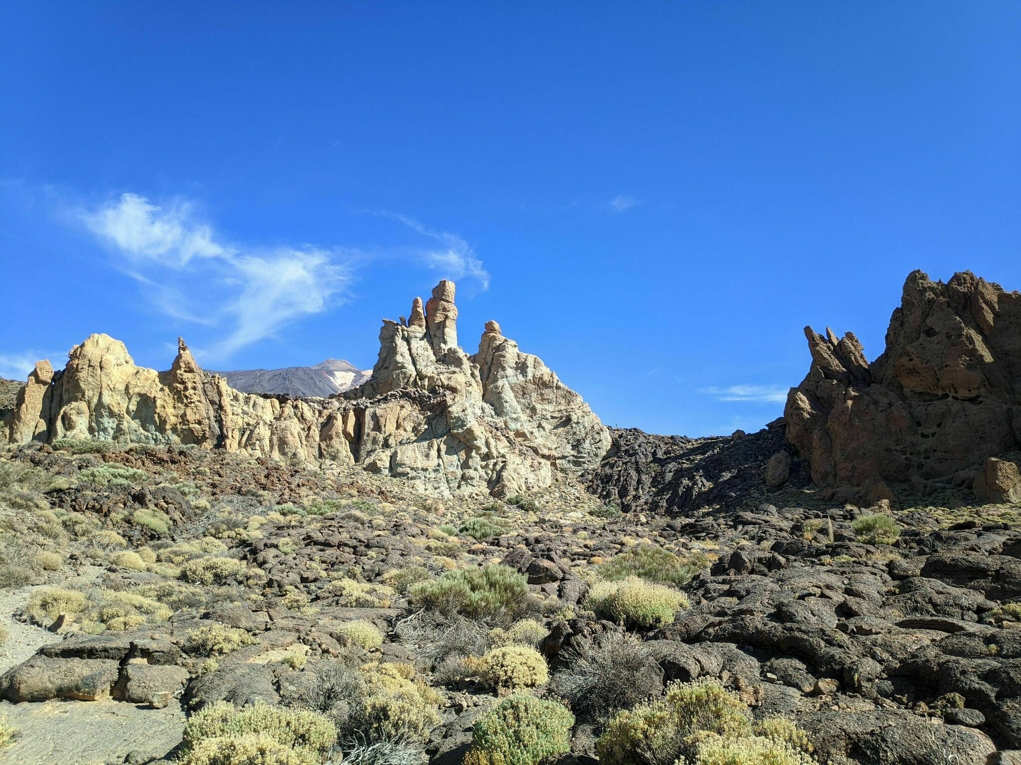
Roques De Garcialas Photo by Florian Co
Pico del Teide is the centre of attention. It is, after all, Spain's highest peak. However, behind the intimidating volcano, there are several hiking paths that explore the Las Caadas caldera. Roques de Garca is a quick and easy trek that everyone should take.
In slightly over an hour, you'll circle the park's most stunning rock formation with Mount Teide in full view. The climb begins at the Mirador de la Ruleta viewpoint, which is right next to Parador Nacional.
The spectacular La Catedral rock protruding out of the Caldera floor may be seen from the Mirador de la Ruleta vantage point. The caldera rim appears to be a stone wall in the backdrop.
Trailhead: Mirador de la Ruleta
Type of Trail: Loop
Distance: 3.4 km
Difficulty: Easy
Time Needed: 1:15 hours
2. BENIJO TO FARO DE ANAGA LIGHTHOUSE CIRCUIT
ANAGA MOUNTAINS

Benjo To Faro Photo by Lucas Zmuda
The Anaga massif is the oldest section of the island and the most magnificent mountain in Tenerife, in our view. The Anaga mountains appear to be a living entity, sliding endlessly into the sea.
We recommend trekking this 6-hour circle path to gain a good glimpse of the Tenerife mountain range.
This Tenerife climb starts in Benijo, a little hamlet near Taganana. The walk follows the shoreline all the way to the lighthouse of Faro de Anaga. You'll climb from here to the settlement of Chamorga, which lies at the extreme end of the Anaga Mountain Road. After then, the track leads all the way back to Benijo.
Trailhead: Benijo
Type of Trail: Circuit
Distance: 11.6 km
Difficulty: Difficult
Time Needed: 6 – 6:30 hour
3. ROQUE DE TABORNO CIRCUIT TRAIL
ANAGA MOUNTAINS

Photo by Artem S
Roque de Taborno, sometimes known as "Tenerife's Matterhorn," is a thumb-shaped rock on the north shore of the Anaga peninsula that reaches 706 metres above sea level. Tenerife's Matterhorn is encircled by a short trail that provides breathtaking views of the Northern Anaga Coastline.
This hiking track in Tenerife begins in the hamlet of Taborno, which is part of the Anaga Rural Park. Locate the chapel when you arrive. You'll descend a few metres to a viewpoint on the right side of the modest church. Continue on the route until you reach Roque de Taborno. The vistas drastically increase as you round the peak clockwise.
Trailhead: Taborno
Type of Trail: Loop
Distance: 3.7 km
Difficulty: Moderate
Time Needed: 1:30 hours
4. PUNTA DEL HIDALGO TO CHINAMADA AND CARBONERAS
ANAGA MOUNTAINS

Photo by Carmen
In Parque Rural de Anaga, this Tenerife hiking trail is generally the most popular. The majority of hikers will begin their journey at the Cruz del Carmen Visitor Center and descend to Punte del Hidalgo. That's certainly the greatest option, particularly if you live in La Laguna. You may take a bus to the trailhead and then take another bus back to La Laguna from Punta del Hidalgo.
Take an out-and-back trek from Punta del Hidalgo to Chinamada and Carboneras, this route ascends slowly over Barranco del Ro to the Troglodyte (cave) village Chinamada from the seashore. Even though the caverns have been updated, people still live in them. When you arrive, go to Restaurante La Cueva for some hearty Canarian cuisine.
Trailhead: Punta del Hidalgo
Type of Trail: Return (out and back)
Distance: 16.1 km
Difficulty: Moderate – Difficult
Time Needed: 6 – 7 hours
5. PARADOR NACIONAL TO MONTAÑA GUAJARA CIRCUIT TRAIL
TEIDE NATIONAL PARK

Photo by Andrey A
In Teide National Park, Montaña Guajara is the tallest peak on the caldera rim. While there are other routes to the peak of Montaña Guajara, we recommend beginning at the Parador Nacional. The rise to the Guajara plateau is slow and steady from here. You'll enjoy a fantastic birds-eye perspective of the caldera scenery and Teide from the summit. It takes 4:30 hours to complete the circular trek.
Trailhead: Parador Nacional (bus stop, hotel, gift shop, and cafeteria)
Type of Trail: Circuit
Distance: 10.1 km
Difficulty: Moderate – Difficult
Time Needed: 4:30 hrs